After a very restful stay we were off again and raring to go. There was a lot of mileage to cover so we knew we'd need some good fuel. Enter Zellar's Restaurant, a little place attached to another motel in the town of Newberry.
Zellar's had a pleasant wait staff and humongous portions. I had the corn-beef hash with a couple of over-easy eggs and some raisin toast and it all was delicious. They did make their hash with hash-browns instead of the normal American Potatoes that I was used to, but it didn't impact the flavor any. Grandma had a bagel, and that was it, her allotted bird seed for the day. Jan and mom had the normal breakfast plate, which was also a lot of food when you combined the bacon, eggs, American potatoes and toast it came with.


Fully fueled, we headed out to see the bears. After all, we had to make sure that we had a good meal, in order to become a good meal for them. In all seriousness though, about four miles out of Newberry is Oswald's Bear Ranch, a family owned operation that takes in orphaned bears and lets them live there in large fenced enclosures. They have separate pens for the grown males, the juveniles, the adult females, and the baby cubs. There were three baby cubs when we went and for $10 you could get your picture taken with them while you stood behind a stump they were sitting on. And the fee to get in was $20 a car load. There was a lot of walking, and it wasn't the most professional looking place in the world, but it was a unique experience and being that close to the bears was fascinating. Surprisingly, mom with her penchant for "bear attacks" was not attacked at this particular area, which was a good thing!
 |
| Anyone else think grandma looks a little traumatized here? |
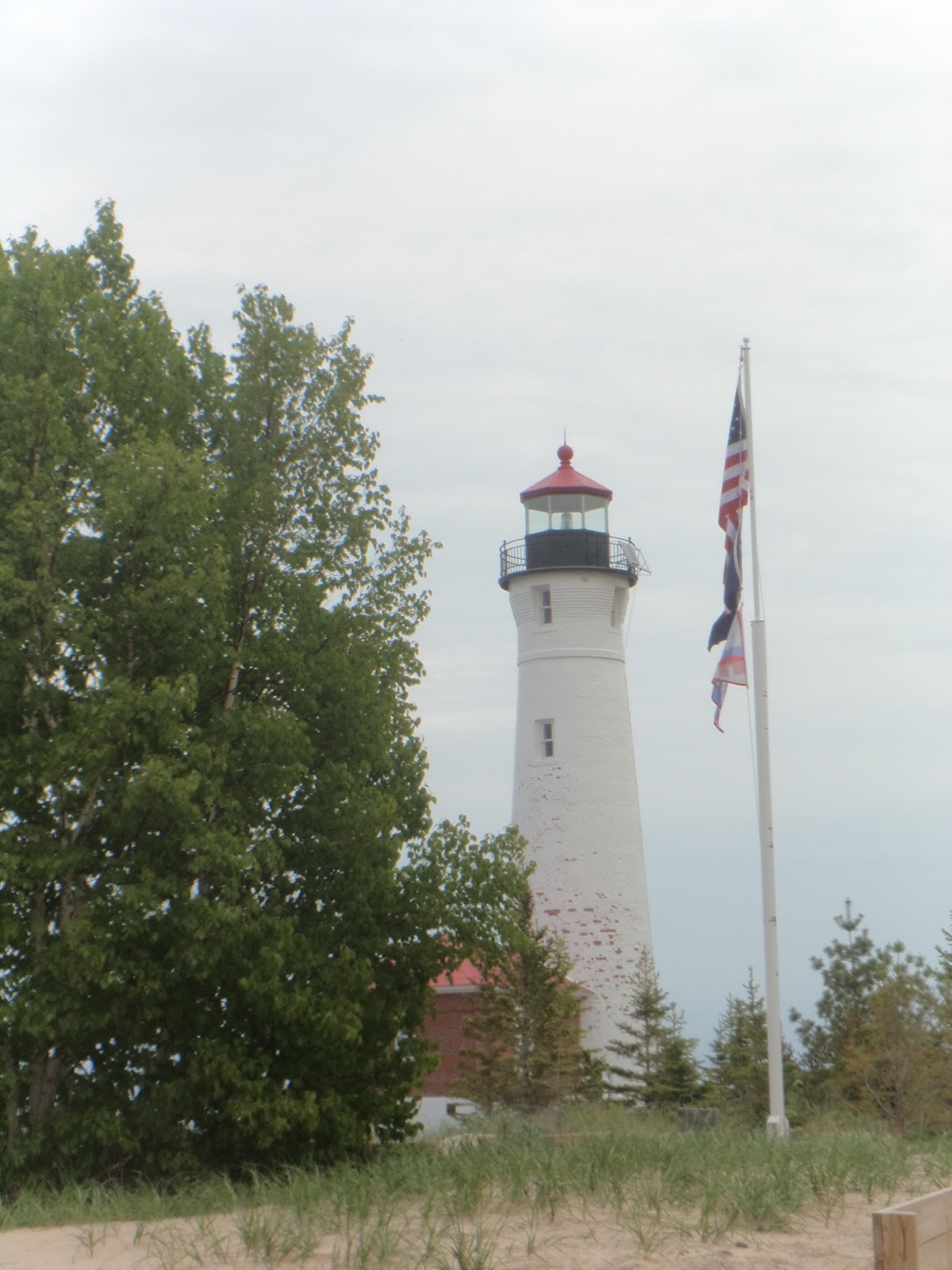
The dirt roads in Northern Michigan are expansive and cover most of the Northern coast. It was on one of these that we went to Crisp Point, the location of a lighthouse that years before had been abandoned, but then became the focus of a private restoration group that has restored it to its former glory. And there was a nice beach there for agate hunting. The place is run by volunteers and one was just leaving as we got there, but she stayed to let us check out the gift shop (and reappeared the rest of the day at the same places we kept going). Sadly her replacement didn't make it there in time so we didn't get to see inside the lighthouse. And I didn't find any agates.
 |
| Crisp Point Lighthouse |
 |
| Crisp Point Lighthouse |
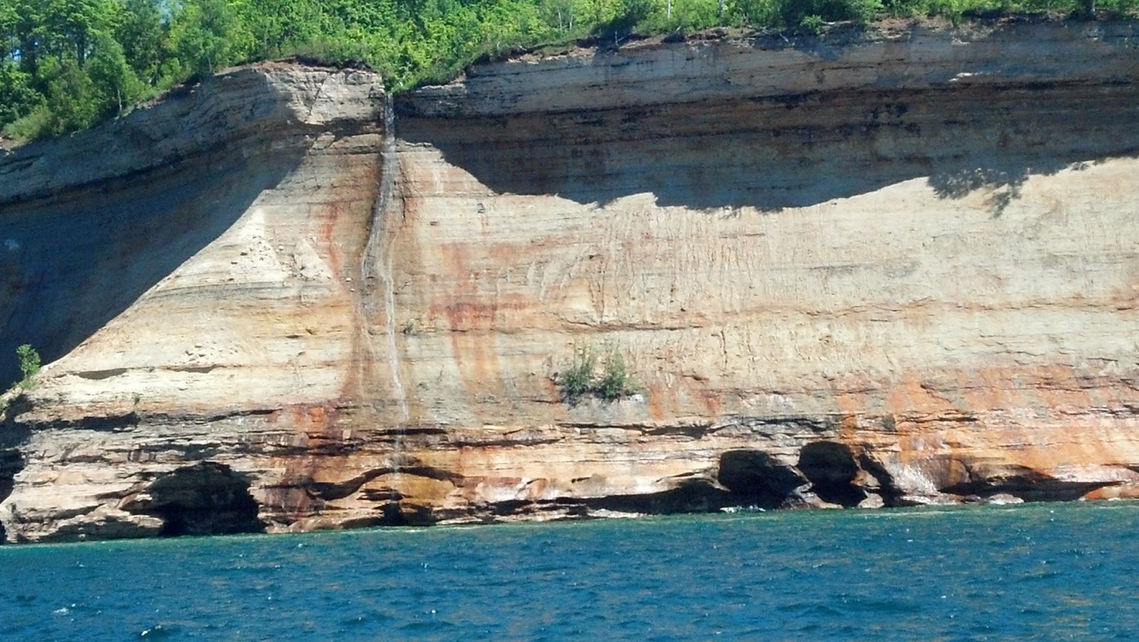
 |
| Under Lake Superior |
 |
| Lake Superior Rocks |
Down the road a couple of miles, through extensive burned forests(there was a large fire in this area last year) is the Two Hearted River. This place has a primitive campground (pit toilets, no electricity), that we used to come up and camp every year when I was younger. The lodge was burned down, but the campground still remained and the bridge going over the river to the beach was still there. What makes this campsite so great is not only its remote location and the memories attached to it, but this bridge that takes you over the Two Hearted River and down the beach is where the river meets Lake Superior, and it is a spectacular sight. On the opposite end of the beach are dunes and a wooded area, where years ago three graves were located up the hill in the wooded area. After the fire, all that remained was some rebar and one outline surrounded by ash and charred stumps. The whole beach was littered with rocks again, and again, no agates were found by me.
 |
| Two Hearted River Campground's bridge |
 |
| Two Hearted River & Lake Superior |
 |
| All that's left of the graves in the woods. |
 |
| Mom on the bridge. |
After a never ending drive in which we thought we were in the twilight zone, we reached the small town of Grand Marais. There was a "splash in" going on in town and the small bay's beaches were covered with small prop planes that people had flew in. We admired the sights and then found our motel up on the hill.
 |
| The planes at Grand Marais. |
At the recommendation of the owner, we went to the West Bay Diner which was a quirky place with no discernible layout, an old diner slapped on the front, and tons of books laying all over, some for sale, some not. While the decor was quirky, the chef was maybe a bit too quirky. He only took one ticket at a time, which made for some long wait times for food, and there was only one waitress trying to help everyone that came in, although I noticed a few others sitting in the back and doing who know's what back there. The poor girl was just overrun with minimal help. The food was not spectacular, I actually was the only one who enjoyed my meal (A Michigan Cherry Sausage with onions, peppers, mushrooms and bacon and a side of bean salad which was super sweet, it also came with a black cherry float that was delicious). Mom and grandma got coleslaw and Whitefish chowder and could hardly get through it because of all the bones left in the soup. Grandma said it was thicker than gravy as well. And Jan had a BLT that looked like a gigantic club sandwich of layers and was too hard to eat in its presentation. So, looks like I won the restaurant lottery in that particular case.
 |
| Grandma and Jan at West Bay Diner. |
And another day ends on a gigantic day of adventure.
 |
| P.S. I finally found my agate at Grand Marais Beach. |